


Memory-Map

Descrizione di Memory-Map
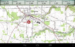
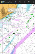
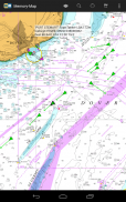
L'applicazione Memory-Map trasforma il tuo telefono o tablet in un GPS esterno o in un plotter cartografico completo e ti consente di navigare con le mappe topografiche USGS, carte nautiche NOAA e altre mappe specialistiche, anche senza un segnale internet wireless.
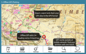
Le mappe vengono scaricate al volo e possono essere precaricate in modo che possano essere utilizzate offline. Una volta caricate l'app e le mappe sul telefono o sul tablet, non è necessaria la copertura di rete cellulare o la connessione Internet per la navigazione GPS in tempo reale.
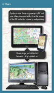
L'app Memory-Map può essere utilizzata come navigatore GPS autonomo, ma può anche essere utilizzata in combinazione con l'app per PC o Mac di Windows (download gratuito) per pianificare, stampare e caricare mappe, waypoint e percorsi verso il telefono / tablet .
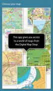
Memory-Map include l'accesso gratuito a mappe topografiche in scala 1: 250.000 e molte altre mappe gratuite in tutto il mondo. Mappe più dettagliate sono disponibili per il download e l'acquisto con un'opzione demo gratuita di prova gratuita prima dell'acquisto. Le mappe disponibili includono Ordnance Survey, Hema, USGS quad, NOAA, Ammiragliato britannico e DeLorme. Le mappe possono essere utilizzate sul PC, sul telefono e sul tablet. La funzione di sincronizzazione del cloud ti consente di mantenere i dati di sovrapposizione coerenti su tutti i tuoi dispositivi.
Le caratteristiche includono:
Accedi a una vasta gamma di mappe e grafici in tutto il mondo.
Scarica automaticamente una mappa gratuita della tua posizione attuale
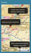
Crea e modifica marchi e rotte.
Importa ed esporta marchi, rotte e tracce nel formato GPX aperto
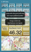
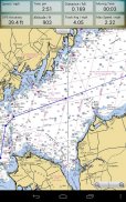
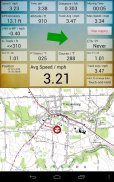
Display; Posizione, rotta, velocità, direzione, altitudine e medie
Le coordinate di posizione includono Lat / Long, UTM e GB Grid
Unità visualizzate in Statuto, Nautico o Metrico
Supporto per sensori GPS e bussola, ove disponibili.
L'indice del nome del file, può essere utilizzato offline.
Spostando la mappa, blocca la posizione GPS e scorre automaticamente la mappa
Registra tracce di breadcrumb / tracklog.
Condividi contrassegni di posizione o tracklist come file GPX
Allarme di prossimità
Funzionalità complete di strumentazione marina, con allarme AIS, DSC e Anchor
Interfaccia dati NMEA tramite WiFi o Bluetooth
Allarme collisione AIS, con soglie regolabili per obiettivi Classe A e Classe B
Visualizza le notifiche di allarme e i dati di navigazione sull'orologio Android Wear
Barometro e altitudine relativa
Memory-Map - Versione 2.9.0
(03-02-2021)
Memory-Map - Informazioni APK
Versione APK: 2.9.0Pacchetto: com.memorymap.mm2Ultima versione di Memory-Map
Altre versioni


 4.63
4.63


App nella stessa categoria


Potrebbe piacerti anche...


